


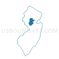
Franklin township ward 1 voting district 30, Somerset County, New Jersey
About
Outline

Summary
| Unique Area Identifier | 621952 |
| Name | Franklin township ward 1 voting district 30 |
| County | Somerset County |
| State | New Jersey |
| Area (square miles) | 3.50 |
| Land Area (square miles) | 3.44 |
| Water Area (square miles) | 0.06 |
| % of Land Area | 98.18 |
| % of Water Area | 1.82 |
| Latitude of the Internal Point | 40.45016400 |
| Longtitude of the Internal Point | -74.58475280 |
Maps


Graphs
Select a template below for downloading or customizing gragh for Franklin township ward 1 voting district 30, Somerset County, New Jersey


Neighbors
Neighoring Voting District (by Name) Neighboring Voting District on the Map
- Franklin township ward 1 voting district 1, Somerset County, NJ
- Franklin township ward 1 voting district 42, Somerset County, NJ
- Franklin township ward 1 voting district 44, Somerset County, NJ
- Franklin township ward 1 voting district 45, Somerset County, NJ
- Franklin township ward 1 voting district 46, Somerset County, NJ
- Franklin township ward 1 voting district 9, Somerset County, NJ
- Hillsborough township voting district 11, Somerset County, NJ
- Montgomery township voting district 12, Somerset County, NJ
- South Brunswick township voting district 24, Middlesex County, NJ
- South Brunswick township voting district 8, Middlesex County, NJ
- South Brunswick township voting district 9, Middlesex County, NJ
Top 10 Neighboring County Subdivision (by Population) Neighboring County Subdivision on the Map
- Franklin township, Somerset County, NJ (62,300)
- South Brunswick township, Middlesex County, NJ (43,417)
- Hillsborough township, Somerset County, NJ (38,303)
- Montgomery township, Somerset County, NJ (22,254)
Top 10 Neighboring Place (by Population) Neighboring Place on the Map
- Franklin Park CDP, NJ (13,295)
- Kendall Park CDP, NJ (9,339)
- Six Mile Run CDP, NJ (3,184)
- Ten Mile Run CDP, NJ (1,959)
- Pleasant Plains CDP, NJ (922)
- Griggstown CDP, NJ (819)
- Blackwells Mills CDP, NJ (803)
Top 10 Neighboring Unified School District (by Population) Neighboring Unified School District on the Map
- Franklin Township School District, NJ (62,300)
- South Brunswick Township School District, NJ (43,417)
- Hillsborough Township School District, NJ (38,721)
- Montgomery Township School District, NJ (22,936)
Top 10 Neighboring State Legislative District Lower Chamber (by Population) Neighboring State Legislative District Lower Chamber on the Map
- General Assembly District 17, NJ (235,142)
- General Assembly District 14, NJ (230,937)
- General Assembly District 16, NJ (215,874)
Top 10 Neighboring State Legislative District Upper Chamber (by Population) Neighboring State Legislative District Upper Chamber on the Map
- State Senate District 17, NJ (235,142)
- State Senate District 14, NJ (230,937)
- State Senate District 16, NJ (215,874)
Top 10 Neighboring 111th Congressional District (by Population) Neighboring 111th Congressional District on the Map
Top 10 Neighboring Census Tract (by Population) Neighboring Census Tract on the Map
- Census Tract 534.04, Somerset County, NJ (10,529)
- Census Tract 538.03, Somerset County, NJ (8,185)
- Census Tract 534.02, Somerset County, NJ (7,387)
- Census Tract 84.03, Middlesex County, NJ (7,142)
- Census Tract 539.05, Somerset County, NJ (6,652)
- Census Tract 84.05, Middlesex County, NJ (5,116)
- Census Tract 534.03, Somerset County, NJ (4,699)
- Census Tract 84.04, Middlesex County, NJ (3,876)
- Census Tract 539.04, Somerset County, NJ (3,516)
Top 10 Neighboring 5-Digit ZIP Code Tabulation Area (by Population) Neighboring 5-Digit ZIP Code Tabulation Area on the Map
- 08873, NJ (49,921)
- 08540, NJ (47,115)
- 08844, NJ (38,367)
- 08824, NJ (12,115)
- 08502, NJ (11,317)
- 08823, NJ (9,016)